factograf
EN
Sign in

river in Western Europe to the North Sea

Rhine

Rhine

Rhine is one of the major rivers of Europe. It rises in the southeastern Swiss Alps, forms parts of several national borders, flows through the German Rhineland, and finally enters the Netherlands before emptying into the North Sea. At about 1,230 km long, it is the second-longest river in Central and Western Europe after the Danube, and it drains an area of 185,000 km2.

Name and origin

Middle Bridge, Basel, Switzerland
River system map of the Rhine, 04
Sections of the Rhine: Rhine–Meuse–Scheldt delta, Lower Rhine, Middle Rhine, Upper Rhine
Lake Toma seen from the upstream end of the Rhine
The confluence of the Anterior Rhine, lower left, and the Posterior Rhine, background, forms the Alpine Rhine (left) next to Reichenau.
Map of the Alpine Rhine
The Rhine between Sargans in Switzerland (left) and Balzers in Liechtenstein (right), with the Gonzen, the Girrenspitz in the back, and the Maziferchopf to the right
Aerial image of the mouth of the Rhine into Lake Constance
Satellite image of Lake Constance, with the Obersee, the delta of the Alpine Rhine, Lake Überlingen with the island of Mainau, and the smaller Untersee with Reichenau Island
Distance markers along the Rhine indicate distances from the bridge in Konstanz
The 555 km marker downstream from the Lorelei
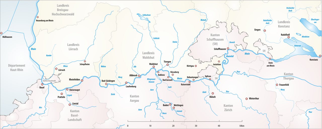
The High Rhine
The High Rhine
12 images

The modern names of the river all derive from the Gaulish name Rēnos, which the Romans adapted as Rhenus. The spelling with Rh- in English and German reflects the influence of Greek orthography. The name belongs to a group of river names built from a Proto-Indo-European root meaning to move or flow.

Climate concerns

Low water in Düsseldorf
The Lower Rhine at Emmerich
The central and northern parts of the Rhine-Meuse delta
Map showing how the waters of the Rhine and Meuse rivers split into branches of their combined delta
The Nederrijn at Arnhem
Schematic cross section of the Upper Rhine Graben
The Rhine at Loreley
Castellum Nigrum Pullum at Zwammerdam, Netherlands, artist's impression by Stevie Xinas
French forces under Louis XIV cross the Rhine at Lobith into the Netherlands in 1672.
Allied soldiers of the Royal Newfoundland Regiment cross the Rhine at Mülheim, Cologne, after the end of the First World War, December 1918
Soldiers of the US 89th Infantry Division cross the Rhine in assault boats under German fire during Operation Plunder on 24 March 1945.
11 images

The International Commission for the Hydrology of the Rhine Basin has warned that climate change could cause a major decrease in the river's volume, and that it could dry up completely during severe drought within the next 30 to 80 years.

In 165 languages

EnglishČeštinaDeutschEspañolFrançaisItaliano日本語PolskiPortuguêsУкраїнська中文AfrikaansShqipአማርኛOld EnglishAragoneseالعربيةEgyptian ArabicAsturianuঅসমীয়াAvaricAzbAzərbaycanBalineseBavarianbat-smgБашҡортБеларускаяБългарскиBhojpuriবাংলাབོད་སྐད་BrezhonegBosanskiБуряадCatalàCebuanoНохчийнکوردیی ناوەندیCorsicanCrimean TatarЧӑваш чӗлхиCymraegDanskZazaDolnoserbšćinaΕλληνικάEsperantoEestiEuskaraفارسیSuomiArpitanNorthern FrisianFryskGaeilgeGalegoGuaraniकोंकणीGothicGaelgHakka ChineseעבריתFiji Hindiहिन्दीHrvatskiHornjoserbšćinaMagyarՀայերենInterlinguaBahasa IndonesiaInterlingueIlokoIdoÍslenskaJawaKara-KalpakქართულიKbpҚазақшаKanuri한국어KölschKurdî (kurmancî)KernewekКыргызчаLatinLëtzebuergeschLezghianLingua Franca NovaLigureLimburgishLldLombardLingálaLietuviųLatviešuमैथिलीMalagasyMariМакедонскиമലയാളംМонголमराठीMelayuMirandeseမြန်မာمازرونیNeddersass’sch (Nedderlannen)Neddersass’schNewariNederlandsNorsk nynorskNorskNyanjaOccitanИронPapiamentoਪੰਜਾਬੀPalatine GermanPiemontèisWestern PanjabiRunasimiRumantschRoa (Tara)RomânăRusynРусскийСаха тылаSicilianuScotsسنڌيSrpski (latinica)SlovenčinaSlovenščinaShqipСрпскиSaterland FrisianSvenskaKiswahiliŚlōnskiதமிழ்ТоҷикӣไทยTürkmen diliFilipinoTalyshTürkçeТатарUdmurtاردوO‘zbekVenetoVepsTiếng ViệtWest FlemishVolapükWarayWalloonWu ChineseMingrelianייִדישZeelandicⵜⴰⵎⴰⵣⵉⵖⵜzh-yue

Редакція Factograf · Published October 14, 2026 · Partly based on Wikipedia, CC BY-SA 4.0 · Source article