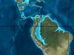
The Regadera Formation (Spanish: Formación Regadera, E2r, Tpr) is a geological formation of the Bogotá savanna, Altiplano Cundiboyacense, Eastern Ranges of the Colombian Andes. The predominantly sandstone and conglomeratic formation, with pink shale beds intercalated, dates to the Paleogene period; Middle to Late Eocene epoch, and has a maximum thickness of 765 metres (2,510 ft).
Etymology
The formation was first described by Hubach in 1931 as part of the Usme Formation and redefined and named in 1963 by Julivert after the La Regadera Reservoir.
Description
Lithologies
The Regadera Formation consists mainly of quartz arenitic sandstone and conglomerates with some shale beds.
Stratigraphy and depositional environment
The Regadera Formation overlies the Bogotá Formation and is overlain by the Usme and Tilatá Formations. The age has been estimated, based on palynological data of Echitriporites trianguliformis var. orbicularis, Nothofagidites sp. and Multiporopollenites pauciporatus, to be Middle to Late Eocene. The depositional environment has been interpreted as a braided river setting.
Outcrops

The Regadera Formation is apart from its type locality in the synclinal of Usme, the valley of the Tunjuelo River, found in the synclinal of Sisga. In the Tunjuelo River valley, the Regadera Formations is present in the escarpments on the river banks.
Regional correlations


| Ma | Age | Paleomap | Regional events | Catatumbo | Cordillera | proximal Llanos | distal Llanos | Putumayo | VSM | Environments | Maximum thickness | Petroleum geology | Notes |
|---|---|---|---|---|---|---|---|---|---|---|---|---|---|
| 0.01 | Holocene | Holocene volcanism Seismic activity |
alluvium | Overburden | |||||||||
| 1 | Pleistocene | Pleistocene volcanism Andean orogeny 3 Glaciations |
Guayabo | Soatá Sabana |
Necesidad | Guayabo | Gigante Neiva |
Alluvial to fluvial (Guayabo) | 550 m (1,800 ft) (Guayabo) |
||||
| 2.6 | Pliocene | Pliocene volcanism Andean orogeny 3 GABI |
Subachoque | ||||||||||
| 5.3 | Messinian | Andean orogeny 3 Foreland |
Marichuela | Caimán | Honda | ||||||||
| 13.5 | Langhian | Regional flooding | León | hiatus | Caja | León | Lacustrine (León) | 400 m (1,300 ft) (León) |
Seal | ||||
| 16.2 | Burdigalian | Miocene inundations Andean orogeny 2 |
C1 | Carbonera C1 | Ospina | Proximal fluvio-deltaic (C1) | 850 m (2,790 ft) (Carbonera) |
Reservoir | |||||
| 17.3 | C2 | Carbonera C2 | Distal lacustrine-deltaic (C2) | Seal | |||||||||
| 19 | C3 | Carbonera C3 | Proximal fluvio-deltaic (C3) | Reservoir | |||||||||
| 21 | Early Miocene | Pebas wetlands | C4 | Carbonera C4 | Barzalosa | Distal fluvio-deltaic (C4) | Seal | ||||||
| 23 | Late Oligocene | Andean orogeny 1 Foredeep |
C5 | Carbonera C5 | Orito | Proximal fluvio-deltaic (C5) | Reservoir | ||||||
| 25 | C6 | Carbonera C6 | Distal fluvio-lacustrine (C6) | Seal | |||||||||
| 28 | Early Oligocene | C7 | C7 | Pepino | Gualanday | Proximal deltaic-marine (C7) | Reservoir | ||||||
| 32 | Oligo-Eocene | C8 | Usme | C8 | onlap | Marine-deltaic (C8) | Seal Source |
||||||
| 35 | Late Eocene | Mirador | Mirador | Coastal (Mirador) | 240 m (790 ft) (Mirador) |
Reservoir | |||||||
| 40 | Middle Eocene | Regadera | hiatus | ||||||||||
| 45 | |||||||||||||
| 50 | Early Eocene | Socha | Los Cuervos | Deltaic (Los Cuervos) | 260 m (850 ft) (Los Cuervos) |
Seal Source |
|||||||
| 55 | Late Paleocene | PETM 2000 ppm CO2 |
Los Cuervos | Bogotá | Gualanday | ||||||||
| 60 | Early Paleocene | SALMA | Barco | Guaduas | Barco | Rumiyaco | Fluvial (Barco) | 225 m (738 ft) (Barco) |
Reservoir | ||||
| 65 | Maastrichtian | KT extinction | Catatumbo | Guadalupe | Monserrate | Deltaic-fluvial (Guadalupe) | 750 m (2,460 ft) (Guadalupe) |
Reservoir | |||||
| 72 | Campanian | End of rifting | Colón-Mito Juan | ||||||||||
| 83 | Santonian | Villeta/Güagüaquí | |||||||||||
| 86 | Coniacian | ||||||||||||
| 89 | Turonian | Cenomanian-Turonian anoxic event | La Luna | Chipaque | Gachetá | hiatus | Restricted marine (all) | 500 m (1,600 ft) (Gachetá) |
Source | ||||
| 93 | Cenomanian | Rift 2 | |||||||||||
| 100 | Albian | Une | Une | Caballos | Deltaic (Une) | 500 m (1,600 ft) (Une) |
Reservoir | ||||||
| 113 | Aptian | Capacho | Fómeque | Motema | Yaví | Open marine (Fómeque) | 800 m (2,600 ft) (Fómeque) |
Source (Fóm) | |||||
| 125 | Barremian | High biodiversity | Aguardiente | Paja | Shallow to open marine (Paja) | 940 m (3,080 ft) (Paja) |
Reservoir | ||||||
| 129 | Hauterivian | Rift 1 | Tibú- Mercedes |
Las Juntas | hiatus | Deltaic (Las Juntas) | 910 m (2,990 ft) (Las Juntas) |
Reservoir (LJun) | |||||
| 133 | Valanginian | Río Negro | Cáqueza Macanal Rosablanca |
Restricted marine (Macanal) | 2,935 m (9,629 ft) (Macanal) |
Source (Mac) | |||||||
| 140 | Berriasian | Girón | |||||||||||
| 145 | Tithonian | Break-up of Pangea | Jordán | Arcabuco | Buenavista Batá |
Saldaña | Alluvial, fluvial (Buenavista) | 110 m (360 ft) (Buenavista) |
"Jurassic" | ||||
| 150 | Early-Mid Jurassic | Passive margin 2 | La Quinta | Montebel Noreán |
hiatus | Coastal tuff (La Quinta) | 100 m (330 ft) (La Quinta) |
||||||
| 201 | Late Triassic | Mucuchachi | Payandé | ||||||||||
| 235 | Early Triassic | Pangea | hiatus | "Paleozoic" | |||||||||
| 250 | Permian | ||||||||||||
| 300 | Late Carboniferous | Famatinian orogeny | Cerro Neiva () |
||||||||||
| 340 | Early Carboniferous | Fossil fish Romer's gap |
Cuche (355-385) |
Farallones () |
Deltaic, estuarine (Cuche) | 900 m (3,000 ft) (Cuche) |
|||||||
| 360 | Late Devonian | Passive margin 1 | Río Cachirí (360-419) |
Ambicá () |
Alluvial-fluvial-reef (Farallones) | 2,400 m (7,900 ft) (Farallones) |
|||||||
| 390 | Early Devonian | High biodiversity | Floresta (387-400) El Tíbet |
Shallow marine (Floresta) | 600 m (2,000 ft) (Floresta) |
||||||||
| 410 | Late Silurian | Silurian mystery | |||||||||||
| 425 | Early Silurian | hiatus | |||||||||||
| 440 | Late Ordovician | Rich fauna in Bolivia | San Pedro (450-490) |
Duda () |
|||||||||
| 470 | Early Ordovician | First fossils | Busbanzá (>470±22) Chuscales Otengá |
Guape () |
Río Nevado () |
Hígado () |
|||||||
| 488 | Late Cambrian | Regional intrusions | Chicamocha (490-515) |
Quetame () |
Ariarí () |
SJ del Guaviare (490-590) |
San Isidro () |
||||||
| 515 | Early Cambrian | Cambrian explosion | |||||||||||
| 542 | Ediacaran | Break-up of Rodinia | pre-Quetame | post-Parguaza | El Barro () |
Yellow: allochthonous basement (Chibcha terrane) Green: autochthonous basement (Río Negro-Juruena Province) |
Basement | ||||||
| 600 | Neoproterozoic | Cariri Velhos orogeny | Bucaramanga (600-1400) |
pre-Guaviare | |||||||||
| 800 | Snowball Earth | ||||||||||||
| 1000 | Mesoproterozoic | Sunsás orogeny | Ariarí (1000) |
La Urraca (1030-1100) |
|||||||||
| 1300 | Rondônia-Juruá orogeny | pre-Ariarí | Parguaza (1300-1400) |
Garzón (1180-1550) |
|||||||||
| 1400 | pre-Bucaramanga | ||||||||||||
| 1600 | Paleoproterozoic | Maimachi (1500-1700) |
pre-Garzón | ||||||||||
| 1800 | Tapajós orogeny | Mitú (1800) |
|||||||||||
| 1950 | Transamazonic orogeny | pre-Mitú | |||||||||||
| 2200 | Columbia | ||||||||||||
| 2530 | Archean | Carajas-Imataca orogeny | |||||||||||
| 3100 | Kenorland | ||||||||||||
| Sources | |||||||||||||
- Legend
- group
- important formation
- fossiliferous formation
- minor formation
- (age in Ma)
- proximal Llanos (Medina)
- distal Llanos (Saltarin 1A well)
Notes and references
Notes
References
Bibliography
- Bayona, Germán; Montenegro, Omar; Cardona, Agustín; Jaramillo, Carlos; Lamus, Felipe; Morón, Sara; Quiroz, Luiz; Ruíz, María C.; Valencia and Mauricio Parra, Victor (2010), "Estratigrafía, procedencia, subsidencia y exhumación de las unidades paleógenas en el Sinclinal de Usme, sur de la zona axial de la Cordillera Oriental - Stratigraphy, provenance, subsidence and exhumation of the Paleogene succession in the Usme Syncline, southern axial zone of the Eastern Cordillera" (PDF), Geología Colombiana, 35: 5–35, archived from the original (PDF) on 2017-03-30, retrieved 2017-03-16
- Montoya Arenas, Diana María; Reyes Torres, Germán Alfonso (2005), Geología de la Sabana de Bogotá, INGEOMINAS, pp. 1–104
Maps
- Fuquen M., Jaime A; Osorno M, José F. (2009), Plancha 190 - Chiquinquirá - 1:100,000, INGEOMINAS, p. 1, retrieved 2017-06-06
- Ulloa, Carlos; Acosta, Jorge (1998), Plancha 208 - Villeta - 1:100,000, INGEOMINAS, p. 1, retrieved 2017-06-06
- Montoya, Diana María; Reyes, Germán (2009), Plancha 209 - Zipaquirá - 1:100,000, INGEOMINAS, p. 1, retrieved 2017-06-06
- Buitrago, José Alberto; Terraza M., Roberto; Etayo, Fernando (1998), Plancha 228 - Santafé de Bogotá Noreste - 1:100,000, INGEOMINAS, p. 1, retrieved 2017-06-06
- Acosta, Jorge E.; Ulloa, Carlos E. (1998), Plancha 246 - Fusagasugá - 1:100,000, INGEOMINAS, p. 1, retrieved 2017-06-06


